Kwande Landslide
LCI : NGA1711131256| Main Information | |
| Landslide Name | : Kwande Landslide |
| Latitude | : 6:37:57 N |
| Longitude | : 9:37:20 E |
| Location | |
| City / District | : Kwande |
| Province | : Benue |
| Country | : Nigeria |
| Reporter | |
| Reporter 1 | : Ogbonnaya Igwe |
| Reporter 2 | : |
| Landslide Type | |
| Material | : Debris |
| Movement | : Slide |
| Velocity (mm/sec) | : Extremely Rapid |
| Depth (m) | : Moderate-Shallow |
| Slope (degree) | : - |
| Volume (m³) | : Large |
| Date of Occurence | |
| Date of Occurence | : Oct 27, 2010 |
| Other Information | |
| Land Use |
Source area : Forest, Farming, Pasture Run-out/deposition area : Forest, Farming, Pasture |
| Other Activity | : Unknown |
| Triggering Factor | : Rainfall |
| Death(s) & Missing | : 3 |
| Houses and other structural damage | : - |
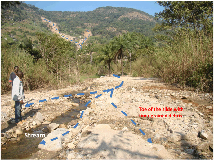
| Photo of landslide | :  |
| Google earth kmz file | : Kwande.kmz |
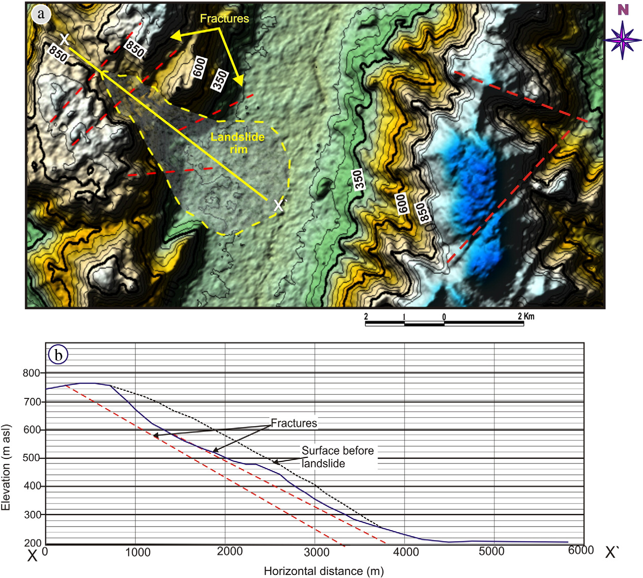
| Plan of landslide | :  |
| Cross section of landslide | : - |
| Reference (paper/report) | : http://dx.doi.org/10.1016/j.geomorph.2014.12.040 |
| Testing graph | : - |
| Monitoring graph | : - |
| Video of moving landslides including 3D simulation | : - |
| Description | : |
Rock-debris Avalanche that occurred on in the Bamenda massif area on the Nigeria-Cameroon Border. The slide occurred on steep hillslopes with a thin veneer of clay-rich soils weathered from Precambrian Basement migmatites, gneisses and granites, forming a complex of mud and rock boulder debris. The slide occurred after an extended period of heavy rainfall in the area. It led to the loss of 3 lives as well as substantial damage to surrounding farmland and pastureland. |
|


