Umka landslide
LCI : SRB1616092150| Main Information | |
| Landslide Name | : Umka landslide |
| Latitude | : 44:40:18.46 N |
| Longitude | : 20:17:53.35 E |
| Location | |
| City / District | : Belgrade |
| Province | : Belgrade area |
| Country | : SERBIA |
| Reporter | |
| Reporter 1 | : Biljana Abolmasov |
| Reporter 2 | : Svetozar Milenkovic |
| Landslide Type | |
| Material | : Earth |
| Movement | : Slide |
| Velocity (mm/sec) | : Slow |
| Depth (m) | : Deep-Moderate |
| Slope (degree) | : Gentle |
| Volume (m³) | : Large |
| Date of Occurence | |
| Date of Occurence | : Jan 01, 1970 |
| Other Information | |
| Land Use |
Source area : Wildland Run-out/deposition area : River |
| Other Activity | : - |
| Triggering Factor | : Erosion |
| Death(s) & Missing | : - |
| Houses and other structural damage | : 500 houses destroyed |
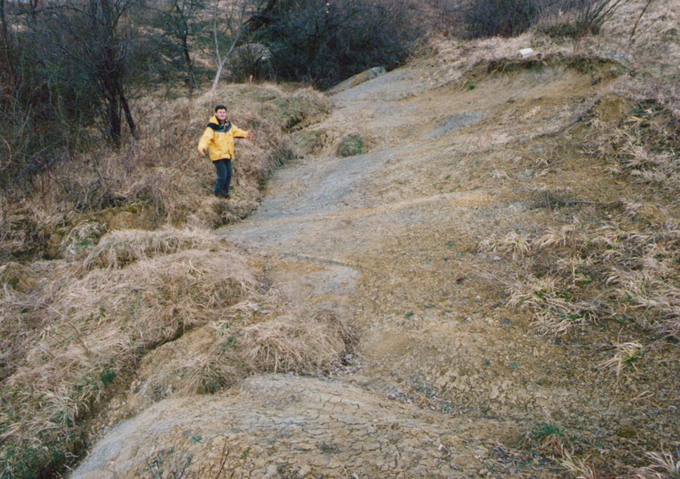
| Photo of landslide | :  |
| Google earth kmz file | : Umka, Serbia.kmz |
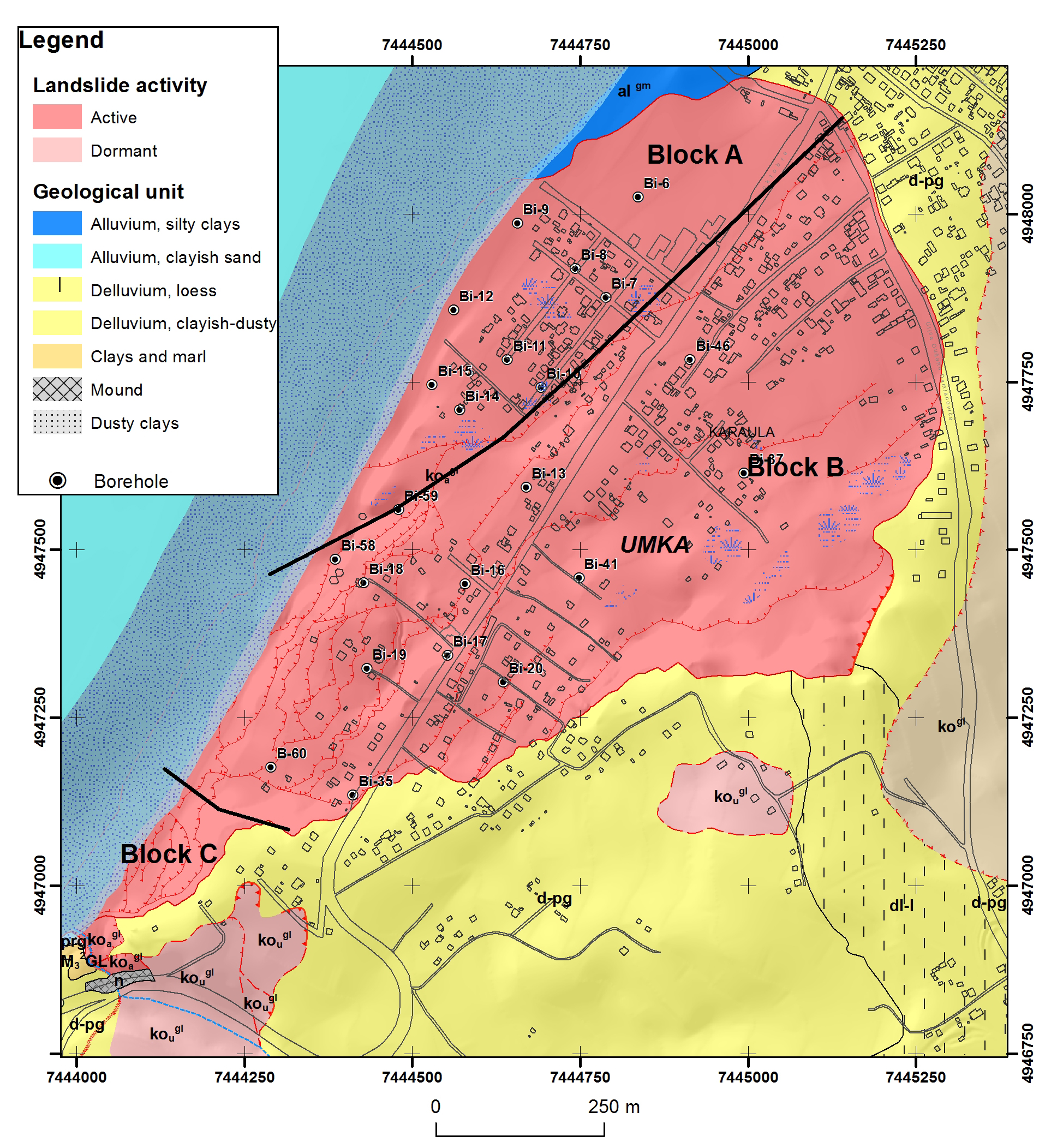
| Plan of landslide | :  |
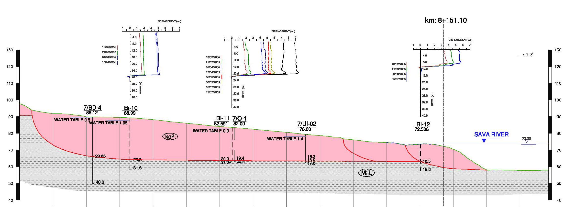
| Cross section of landslide | :  |
| Reference (paper/report) | : http://link.springer.com.proxy.kobson.nb.rs:2048/content/pdf/10.1007s10346-014-0499-4.pdf |
| Testing graph | : Testing diagrams Umka.pdf |
| Monitoring graph | : art%3A10.1007%2Fs10346-014-0499-4.pdf |
| Video of moving landslides including 3D simulation | : - |
| Description | : |
Landslide Umka is located 25 km south-west of Belgrade and has been researched in detail over the past 35 years, which provided extensive geotechnical documentation as well as a great number of published papers. Landslide Umka is located on the right bank of the river Sava in the crook of the large right meander before its confluence with Danube. Total length of the landslide is approximately 1700 m and its width is around 900 m. Average gradient of the slope is 9o, however, the inclination is greater in the upper sections of the terrain above the 80-85 meters above the sea level – up to 15o, while closer to the banks it is much less severe – up to 6o. Also, within the body of the landslide in the zones of the minor scarps, the gradient is greater – up to 15o. Landslide covers the area of approximately 1.8 sq km, and is in the shape of a wide fan, with volume of around 14,000,000 m3. Analysis of numerous laboratory results of research of samples taken from the colluviums, sliding planes and bedrock, defined the parameters representing their mechanical characteristics. Data analysis from inclinometer monitoring during 2005, type and amount of precipitation, temperature regimen, observation of the levels of underground waters in piezometers, as well as the measuring of levels of the Sava, allowed the conclusion that the intensifying of activity was caused by sudden increase in Sava levels, sudden thaw followed by a quick drop in Sava level. After the automated GNSS monitoring in the last six years, similar pattern was observed. Umka landslide is typical slow moving landslide with phases of intensive and slower movements, directly dependent from the precipitation regime and the levels of Sava. Reference: Abolmasov, B., Milenković, S., Marjanović, M., Đurić, U., Jelisavac, B. (2015). A geotechnical model of the Umka landslide with reference to landslides in weathered Neogene marls in Serbia. Landslides, Vol 12 (4): 689-702. DOI 10.1007/s10346-014-0499-4. |
|


