Main Information
LCI: PAK169151000
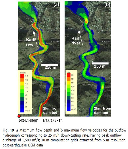
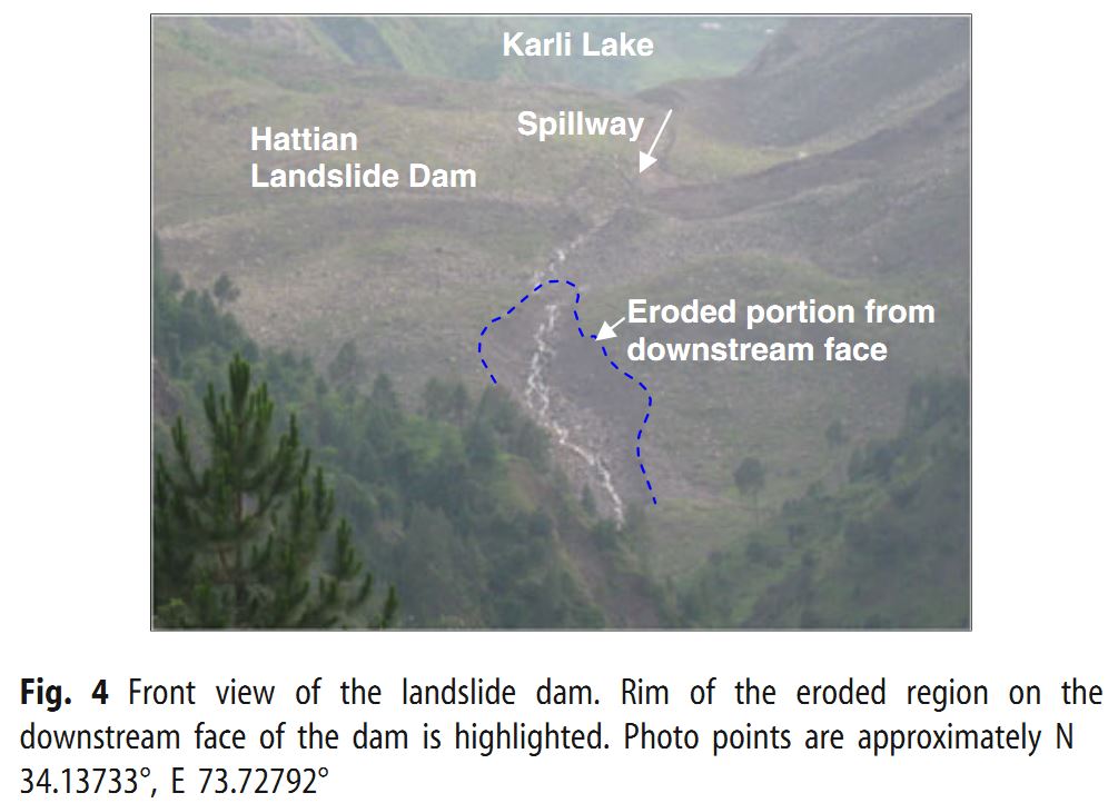
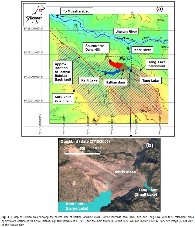
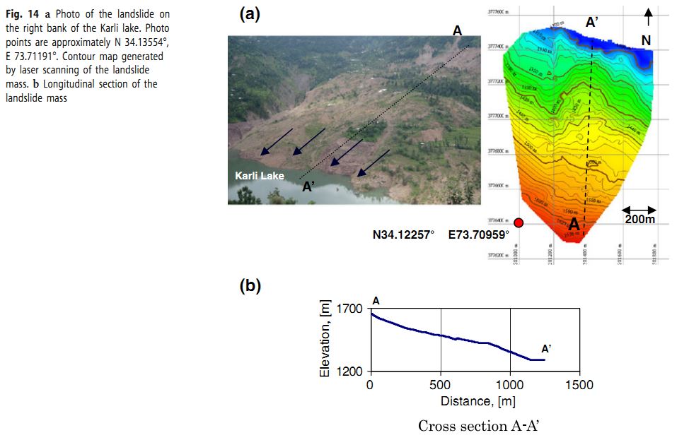
On October 8, 2005, a huge landslide triggered by Kashmir earthquake (M 7.6) at Hattian Bala Town in the state of Azad Jammu Kashmir of Pakistan. The Hattian Bala landslide dam had a maximum depth estimated up to 500 m. The debris mass of 65 million m3 blocked two tributaries of the Karli branch of the Jhelum River and formed Karli Lake and Tang Lake. The disaster posed secondary hazards to the people living downstream of both the Karli and the Jhelum Rivers, such as the potential risk of flooding, landslide dam breaching, slope deformations/erosions. After the event, structural countermeasures were carried out to strengthen the dam. However, after a period of about four years and four months, Karli Lake breached the northwestern part of the dam on 9th February 2010 due to a continuous 5-day rainfall. Later on, Tang Lake also breached the northeastern lobe of the dam due to monsoon rains during the period from July to August of 2010. Post-formation behaviors of the landslide and breaching-inflicted changes were analysed by Konagai et al. (2011). Source: Kazuo Konagai, Ahsan Sattar (2011) “Partial breaching of Hattian Bala Landslide Dam formed in the 8th October 2005 Kashmir Earthquake, Pakistan”, Landslides Vol.9 (1), 11 pages.
Location
City / District: Hattian Bala
Province: Azad Jammu Kashmir
Country: Pakistan
Latitude: 34:8:34 N
Longitude: 73:43:8 E
Reporter
Reporter 1: Pham Tien
Reporter 2: Kazuo Konagai
Landslide Type
Material: Debris
Movement: Slide
Velocity (mm/sec): Unknown
Depth (m): Unknown
Slope (degree): Unknown
Volume (m³): Very Large (10⁷-10⁸)
Date of Occurence
Date of Occurence: 10/08/2005
Other Information
Land use (Source Area): Forest
Land use (Run-out/deposition area): River
-
Triggering Factor: Others
-
Photo of landslide
Google earth kmz file
Plan of landslide
Cross section of landslide
Reference (paper / report) (Insert link)
Testing graph